Aug 18-08

Past-E-Mail: Cam Notes - 2008: August: Aug 18-08
Baraga below    ...scroll down to share comments
Photos by E. Neil Harri
Baraga/Houghton County line    ...scroll down to share comments
Photos by E. Neil Harri


By
Mary Drew at Pasty Central (Mdrew) on Monday, August 18, 2008 - 03:57 am:

E. Neil Harri is at it again, bringing us scenes from the sky that are fascinating to say the least. Today we're buzzing over the village of Baraga, where you can make out several landmarks of the area... the two marinas on either end of the village, the Baraga High School, with the football field right behind it; the Pettibone plant; and I think that's the Ojibwa Resort up in the left corner. Neat to see all these things at once from the air.

Then Neil headed north and captured a shot of the Baraga/Houghton County line from above. I never realized there were cliffs like that along the shoreline there. At first I thought this was a photo taken of the Pictured Rocks area near Munising. It looks like they could be comprised of sandstone and it also looks like this is another place I'm going to have to put on my "kayaking to do" list. So many places to paddle, so little time.


By Donna (Donna) on Monday, August 18, 2008 - 07:10 am:

GO NEIL!!!


By Deb S. (Usedtobeayooper) on Monday, August 18, 2008 - 07:14 am:

Very nice shots! Thank you Neil.


By Serena Sturm (Serena) on Monday, August 18, 2008 - 07:29 am:

Beautiful pics!


By Alex "UP-Goldwinger" (Alex) on Monday, August 18, 2008 - 07:43 am:

I can see the Baraga Best Western Hotel on the waterfront in the first photo. It's one of the better hotels that I have stayed at and the ride along the coast heading up to Houghton is fantastic (especially on a motorcycle).


By Deb S. (Usedtobeayooper) on Monday, August 18, 2008 - 07:48 am:

I've often wondered how that hotel was. You're right, the drive to Houghton is great, and continuing to Lake Linden. But I still say they need to cut down some of the trees if they want to call these routes the circle tours. The idea was seeing the lake. We can see trees anywhere.


By Capt. Paul (Eclogite) on Monday, August 18, 2008 - 07:52 am:

Those cliffs are Jacobsville Sandstone, Mary. That same sandstone forms the cliffs between Baraga and L'Anse along 41, below the Bishop Baraga monument. There is a roadside park above those cliffs in the photo as well, hidden behind the trees.

I don't believe the county line is at those cliffs though; the line is further north than that, between the Arnheim and Klingville roads.....


By Rowdy (Roudymi) on Monday, August 18, 2008 - 07:58 am:

Go Jacobsville!


By E. Neil Harri (Ilmayksi) on Monday, August 18, 2008 - 07:59 am:

Yeah, the county line is a little further North.


By Janie T. (Bobbysgirl) on Monday, August 18, 2008 - 08:05 am:

Getting high with Neil! Great pics!


By Heikki (Heikki) on Monday, August 18, 2008 - 08:46 am:

"There is a roadside park above those cliffs in the photo as well, hidden behind the trees."

Sounds like the same park my family stopped at to eat a pasty lunch after picking strawberries during the early 1950's. We'd always stop there on our way back to Iron River with the car's trunk full of berries. If memory serves, those days pick-your-own strawberries cost 10 cents per quart. Man! That was a long time ago.


By Cindy Pihlaja Russell (Gone2long) on Monday, August 18, 2008 - 09:09 am:

Our family used to drive to the A&W root beer stand between Baraga and L'Anse when we were kids. That was a really big deal back then. When I drive by there now it seems so small. We then went to the new A&W after they moved into Baraga. Is it still there?


By Brooke (Lovethekeweenaw) on Monday, August 18, 2008 - 09:34 am:

Look at how the sky relflects in the water in the 2nd picture, that is amazing.

I never knew those cliffs were there either. That must be pretty to see from the water.


By Marsha, Genesee/Aura (Marsha) on Monday, August 18, 2008 - 09:47 am:

You have no idea, Brooke! We view those cliffs looking west from our cottage window in Aura. At sunrise, they glow a bright, blinding red! We tell everyone we get to enjoy sunrises and sunsets by looking west across Keweenaw Bay from our window! The name "Aura" cracks me up, because it sounds so heavenly. Actually, it received it's name by being Finnish for "the plow"! When the settlers left the Keweenaw copper mines to farm in our area, they discovered that the ground was rocky and for some reason called the area "the plow". Click on my name above for our view at sunset.

Cindy, the drive-in is still there and always has great food and service.


By Cheryl Heppler (Hepplc) on Monday, August 18, 2008 - 10:07 am:

Great photos. I can see my parents home on the lake front. Thanks.


By Jacobsville (Barb) on Monday, August 18, 2008 - 10:15 am:

Hey, I agree with Rowdy! Go Jacobsville!!!

(not that I'm prejudiced or anything :)


By Marsha, Genesee/Aura (Marsha) on Monday, August 18, 2008 - 11:07 am:

Capt. Paul, read my above post and tell me why those cliffs glow a blinding red when the sun shines on them at sunrise. My husband says there is copper in them. I know you'll have a much more complicated (and correct!) answer!


By FRNash/PHX, AZ (Frnash) on Monday, August 18, 2008 - 11:13 am:

Marsha, Genesee/Aura (Marsha):
"… for some reason [they] called the area "the plow"."


I suspect comes from the overall shape of the Abbaye Peninsula (perhaps ignoring Pequaming), which looks vaguely like a long skinny moldboard portion of a plow, with Point Abbaye being the "tip of the plow".


By Capt. Paul (Eclogite) on Monday, August 18, 2008 - 01:46 pm:

The Cliff Notes version is that Jacobsville Sandstone has no copper in it. The red colour comes from iron precipitating out and causing the entire formation to rust, except for a few white reduction spots.

I (or the good Dr.) will have a better answer tonight, after we're done fighting heavy rain and heavier traffic on the way home....


By Dorothy Stewart (Bootjackbabe) on Monday, August 18, 2008 - 02:51 pm:

Have a trivia questions for all you yoopers.
Just drove through Calumet and Laurium and was amazed at how many churches there are in both towns.
Does anybody know who many there are---both in service and not used-----just the buildings. Some seem to be vacant. There is a group of them near the strip mall by subway. My sister can remember taking the train from Hancock to Calumet to visit my relatives and she said the town was very active in the churches. Thanks.


By Paul H. Meier (Paul) on Monday, August 18, 2008 - 05:52 pm:

Dorothy,
I don't have an exact count off the top of my head, but somewhere in the 30's seems right. I'm not sure anyone has an all time total, but Dr. Lankton's local histories may have a count. The reason for the large number is that the "melting pot" of the the early Copper Country had its limits. Folks tended to want to go to church with their own ethnic groups. The Catholic Churches are the most noticeable examples. There are French, Italian, German/Irish, Slovenian/Croatian, etc. Same with the Lutherans, the Germans, Finns and maybe the Swedish had their separate churches. On the other side of the coin, the saloons followed the same ethnic patterns. Saloons out numbered churches but had lower seating capacities. Some of the ethnic societies had their own buildings that served various functions.
All part of the colorful history of the Copper Country.


By Dr. Nat (Drnat) on Monday, August 18, 2008 - 08:42 pm:

Sandstones begin as loose bits and pieces of sand, just like what you would find on a beach or in a river today. Over time, the sand is buried and undergoes a process called lithification. There are two important things that happen during lithification: compaction and cementation. Compaction is exactly what it sounds like, the weight of overlying sediment squishes the little sand grains together. The second important part of lithification is cementation. Basically, water flows through the sediment, leaving behind minerals in the space between the little sand grains. (This is just like what happens in a coffee pot or a shower head-- that white stuff is minerals left behind from water). Anyway, those minerals, the cement, act as a glue holding the little sand grains together. The squished and glued together sand is now officially sandstone.

Now the question is, why do different sandstones have different colours? After all, sandstones can be red (like the Jacobsville), white, tan, black, grey, and even green, amongst other colours. The colour, in most cases, is caused by the cement. Depending on what mineral the cement is, usually controls what colour the sandstone will be. In the case of the Jacobsville, there is a little bit of oxidised iron (better known as rust) in the cement and that is what gives it the brilliant red colour. If you look at the Jacobsville under a microscope, you can actually see a little rim of rust around the the sand grains. I've always found it amazing that such a little rim can give a sandstone such a beautiful colour.


By Marsha, Genesee/Aura (Marsha) on Monday, August 18, 2008 - 09:09 pm:

Thanks, Dr. Nat and Capt. Paul! My husband says we'll have to sell our cottage now that his bubble has been burst and there is no copper in the sandstone cliffs across the bay. Not going to happen!


By John O'Reilly (Johninbevhills) on Monday, August 18, 2008 - 09:23 pm:

Cindy, the A&W is still there, except is now has a different name. Not sure what it is. My Uncle opened the A&W in the summer of 1958. I worked there during the summer of '58 and the summer of 1959. I drank so much root beer during those two summers, that I didn't have another A&W for 20 - 25 years. Enjoyed my time their, met a lot of great people.


By David Soumis (Davesou) on Monday, August 18, 2008 - 09:36 pm:

just had lunch at that drive in restaurant in Baraga last weekend when we went up for Aunt Frieda's 100th birthday.

Its called the BARAGA DRIVE-IN ... pretty catchy, yes ? :)

They serve a wicked good, (that's Mainer talk talk, by the way ), burger. A huge bunch of fries, and some really good onion rings.
I do have to say the chocolate malt didn't taste like a malt at all. It's really hard to find a good malted anymore...they are rare.


By David Soumis (Davesou) on Monday, August 18, 2008 - 09:40 pm:

check this out...some close up pics of those cliffs...scroll down pretty far fot this, but you will probably enjoy the rest of them as well
http://chassell.info/Superior/


By Deb S. (Usedtobeayooper) on Monday, August 18, 2008 - 10:09 pm:

Our malts out here at our DQ are excellent. I just love a good chocolate malt. There's also a 50's style diner out here in St. Cloud, MN. that serves a mean chocolate malt right in the silver cups they're made in. Of course, they cost an arm and a leg.


By Pez Dog (Pezdog7) on Tuesday, August 19, 2008 - 12:07 am:

If they removed all the toxic smelting dust from Torch Lake, how come they have not removed it from the Red Sands at Lac La Belle? People are laying and bathing in that crap?????


By Paul H. Meier (Paul) on Tuesday, August 19, 2008 - 06:52 pm:

Pez Dog,
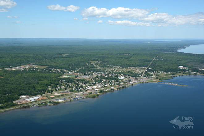
There was a smelter built at Lac La Belle, but it was never used. The red sands are stamp sands from the stamp mill that was right next to Haven Falls Park. The "sands" are crushed rock from Conglomerate Mine at Delaware. One sad fact about the mines at Delaware is they never had enough copper to pay. Since there wasn't much copper in the red rock to begin with, there is even less left in those sands. The milling process was purely mechanical - only water was used. They are small rocks with a very little bit of metallic copper.
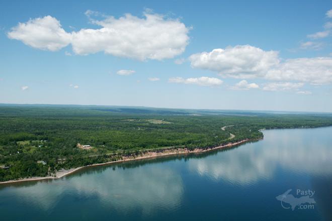
Torch Lake was home to many stamp mills and the C&H smelter. The stamp sands in Torch Lake have been through the mill twice. In the old days, the process was mechanical. Later the mills added ammonia leaching and flotation to the process and the older sands were dredged up and run through reclamation plants. The sands are also much finer in Torch Lake. The finer copper left in the sands and the residual chemicals from the leaching and flotation plus water produced some undesirable results. The smelter itself was not a big source.
Through most of it working life it produced copper and slag. Slag is the glass like residue of molten rock. The stack emissions were common to all coal fired operations. The worst stuff to go through the smelter was some ore from White Pine while C&H owned in the 19 teens and zinc coated cable after WWII. There are also allegations of spills and deliberate dumping of chemicals by C&H's successor.
People in the Copper Country have been recycling poor rock and stamp sand since mining started. It is used in buildings, fills, pavement, walkways, drive ways, play grounds, break waters, etc. etc. If you are afraid of the red sands at Lac La Belle, stay out of the Copper Country, you can't escape it. The Copper Country is probably the most benign mining districts in the world due to the native nature of the copper. Most lawns and gardens have more toxic chemical residues in them the Red Sands of Lac La Belle.


By John Preisler (Jpreisler) on Wednesday, August 20, 2008 - 08:41 am:

I've been looking for the Baraga lighthouse for *years* and someday I'm going to find it...

I try real hard not to trespass, especially when its posted, and I'm pretty sure the lighthouse is on private land.

Baraga is far more friendly to the traveler with a dog than L'anse.

I think the ecosystem of the Keweenaw has recovered fantastically from the inherently messy business of mining. The people have adapted admirably too.

There's no place I'd rather be! :)


Powered by:  
Join Today!
Each day the Pasty Cam has 2 areas to post messages: 
  • Cam Notes - comments related to today's picture and discussion
  • What'sUP - other topics, conversation and announcements
  • *** Please use the appropriate forum ***
    Here's a list of messages posted in the past 24 hours
    See our guest photo gallery for more great views from the U.P.

    Add a Message


    A user/password combination is now required to post messages to Cam Notes. Registration is free. Click here to register or maintain your I.D.
    Username:  
    Password:

    Home | Pasty Cam | Contest | Order Now | Bridge Cam | Past-E-Mail | GP Hall of Fame | Making Pasties | Questions