Jan 27-16

Past-E-Mail: Cam Notes - 2016: January: Jan 27-16
Mushroom high    ...scroll down to share comments
Photos by Brenda Leigh
On the trail    ...scroll down to share comments
Photos by Brenda Leigh
Flowing creek    ...scroll down to share comments
Photos by Brenda Leigh
Hidden sun    ...scroll down to share comments
Photos by Brenda Leigh
Tree huggers    ...scroll down to share comments
Photos by Brenda Leigh
End of the journey    ...scroll down to share comments
Photos by Brenda Leigh
Interesting info    ...scroll down to share comments
Photos by Brenda Leigh
18 years of the Pasty Cam on this day...
...from 1999
to 2016

click to enlarge
1999 2000 2001 2002
2003 2004 2005 2006 2007
2008 2009 2010 2011 2012
2013 2014 2015 2015
Also find us on
facebook
yes Printed on Recycled Internetyes

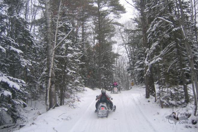
By
Mary Drew at Pasty Central (Mdrew) on Wednesday, January 27, 2016 - 08:53 am:

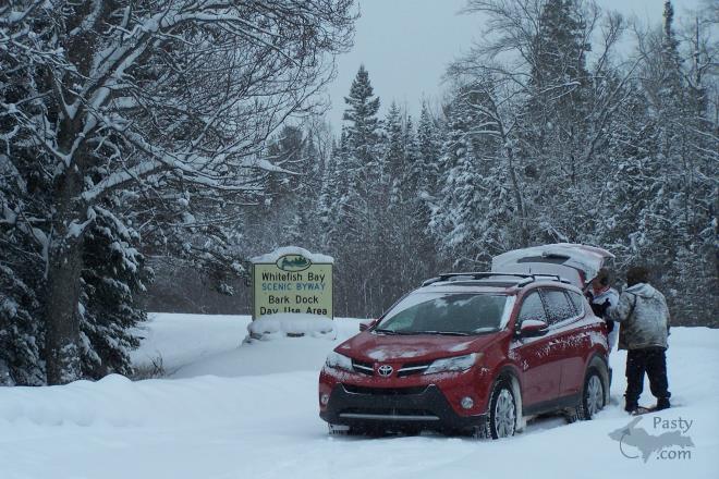
We're off on our second snowshoeing adventure for the week, this time with our guide, Brenda Leigh, her hubby, Jim and friends. The trail they're taking us on is through the Bark Dock Scenic Byway at Whitefish Point. Brenda gave me a play by play account of each photo and it went like this…

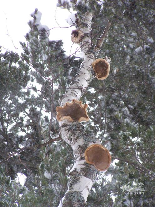
"OK, so to set the tone for this hike, we start with PHOTO 1...we will call it a Mushroom High. My friend Renee spotted these mushrooms about fifteen feet up in a tree. I knew then that we would have a high time on this hike.
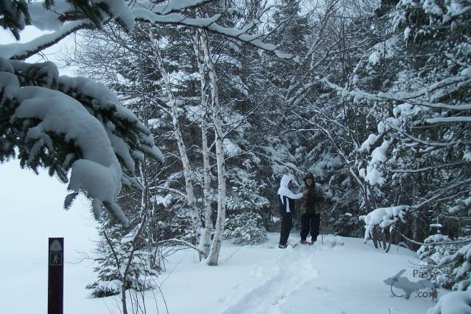
PHOTO 2 - Renee and Jim on the trail.
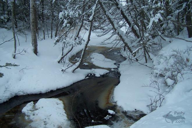
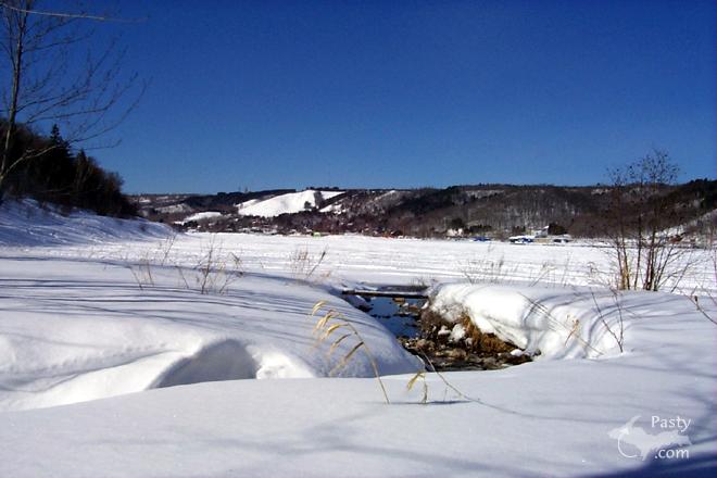
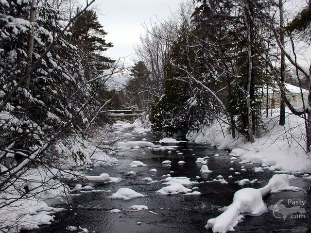
PHOTO 3 - There were three creeks on this hike and the trail takes you back up to the main road to cross over the bridges and then back down. I do not know the name of this creek; however I loved the tannin's in the water.
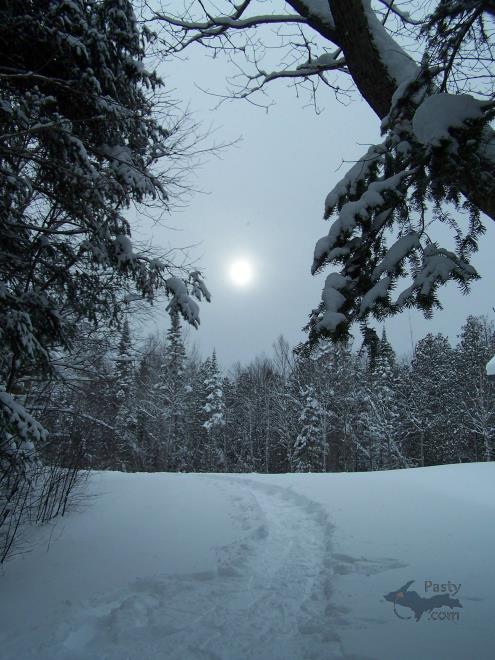
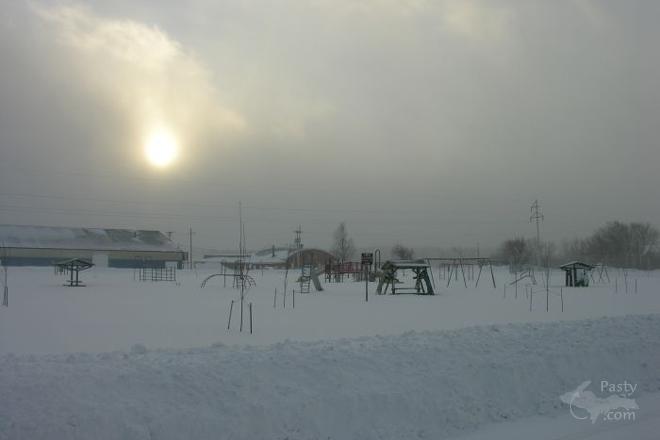
PHOTO 4 - The sun...it was out all day during the hike but was hidden from the cloud cover and snow that was falling.
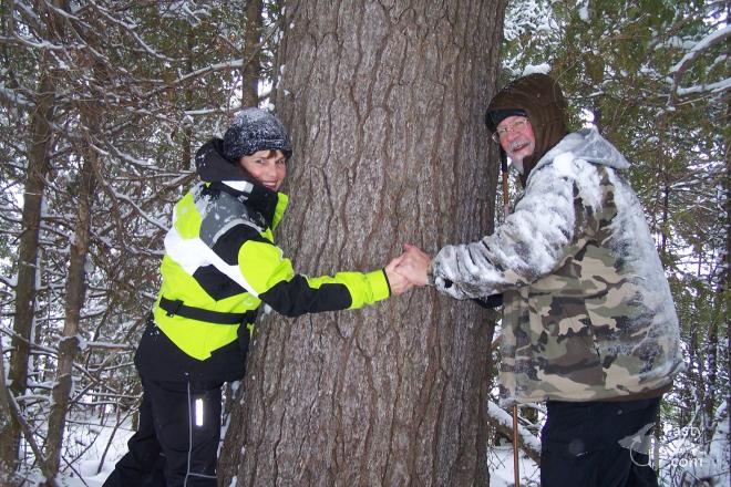
PHOTO 5 - Jim and Brenda the tree huggers predict this White Pine tree to be over 100 years old.
PHOTO 6 - The end of a 3 mile journey on snowshoes.
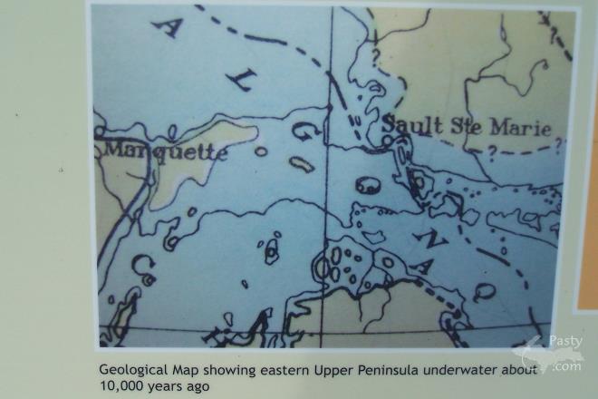
PHOTO 7 - Very interesting indeed…this is an info board that was located at the beginning of our hike. It shows how most of the area was under water 10,000 years ago, along with explaining to us why there is a tremendous amount of sand located on a 100 foot hill behind our house in the area, too.
That concludes our adventure for today. Feel free to sit for a while and relax after that long hike.
By
jbuck (Jbuck) on Wednesday, January 27, 2016 - 10:01 am:

Wow, would i have liked to be along on that trip! Beautiful shots!


By Deb S. (Usedtobeayooper) on Wednesday, January 27, 2016 - 10:06 am:

Awesome, as always, Brenda! You do know to have
fun in all of the seasons and we do enjoy your
adventures.


By Just me (Jaby) on Wednesday, January 27, 2016 - 10:21 am:

I love how people get out into the snow and onto the
nature trails all winter long and take fabulous
photos!Very enjoyable pics!


By Duane P. (Islandman43) on Wednesday, January 27, 2016 - 11:17 am:

Great set of pictures of the winter woods. Thanks for sharing. That was a wonderful hike, I'm all tuckered out and need a nap now. Naps are our friend.


By Capt. Paul (Eclogite) on Wednesday, January 27, 2016 - 12:07 pm:

Wonderful photos Brenda!

Since I am home today taking care of a sick but recovering Dr. Nat, I will elaborate on Brenda’s last photo (Photo 7) a bit. Indeed, the Great Lakes have been much higher (and much lower) than present day lake levels. As the glaciers advanced and retreated several times over thousands of years, so too did lake levels. The stage mentioned on the map is the Algonquin, a period about 10,000 years ago when present day Lakes Huron and Michigan were at approx. 605 feet above sea level (present day lake level is approx. 580 feet). Other notable stages include the Nipissing, and the Algoma. A great example of the different lake stages can be dramatically seen on Mackinac Island from St. Ignace. In the photo below, I labeled some of the features including the Ancient Island which was exposed during the Algonquin stage mentioned on the map. The other ridges pertain to the Nipissing and Algoma stages. Now, you’re probably looking at the Ancient Island and thinking “that looks a lot higher than 15 feet from current lake level”, and you’d be right! The reason for this is when all that ice (some say 2 miles thick) is covering the land, it tends to depress the landscape, exactly what is happening to Greenland with its ice sheet. Once the weight of the ice is gone, the land tends to want to rise to its former level, something we call isostasy. Thus, the Ancient Island is much higher than 15 feet from current lake level because the land has risen over the past 10,000 years and is in fact still rising, albeit much slower than in the past.

MackIs

Thus, your lesson of the day!


By Thomas Baird (Thomas) on Wednesday, January 27, 2016 - 03:31 pm:

Lovely snow scenes.


By jbuck (Jbuck) on Wednesday, January 27, 2016 - 03:46 pm:

Very interesting, Capt! I was looking at that map and trying to figure out what the high points were (shown as islands on the map). Thought one might be Mission Hill near Brimley, but the large island on the Eastern end of the UP appears to be too far West to be Mission Hill.


By James W. Hird (Wvyooper) on Wednesday, January 27, 2016 - 06:00 pm:

OK Capt. Paul:
Is there a site I can go to find the lake levels you listed? Especially interested in the copper country area.


By Alex "UP-Goldwinger" (Alex) on Wednesday, January 27, 2016 - 08:26 pm:

Why Capt., I'm terrified, petrified, mortified, stupefied by you! :-0
(John Nash)
...and BTW, that was a great movie.


By Alex "UP-Goldwinger" (Alex) on Wednesday, January 27, 2016 - 08:30 pm:

...and Dr. Nat, get well soon...please.


By D. A. (Midwested) on Thursday, January 28, 2016 - 10:54 pm:

Isle Royale National Park is a wonderful place
to observe some of the ancient shorelines. The
long island has several parallel ridges,
running much of the length of the island. As
you walk some of the trails on the smaller
ridges you can easily imagine the ancient
version of Lake Superior washing up to the
ridge that is now substantially higher than the
present lake level. As you walk many of the
trails you're sometimes tempted to stop to hunt
for agates as there are many areas covered with
the small and medium sized stones found on Lake
Superior beaches.


Powered by:  
Join Today!
You are welcome to comment here or on 
Pasty Central's Facebook page
Here's a list of messages posted in the past 24 hours
See our guest photo gallery for more great views from the U.P.

Add a Message


A user/password combination is now required to post messages to Cam Notes. Registration is free. Click here to register or maintain your I.D.
Username:  
Password:

Home | Pasty Cam | Contest | Order Now | Bridge Cam | Past-E-Mail | GP Hall of Fame | Making Pasties | Questions