Mar 28-04

Past-E-Mail: Cam Notes - 2004: March: Mar 28-04
Open for the Season    ...scroll down to share comments
Photo from Russ Emmons

By
Toivo from Toivola on Sunday, March 28, 2004 - 09:05 am:

Reviewing the previous weeks comments, brought this shot to mind for the perfect Shoebox Memory to compliment all the icy talk we've enjoyed. Russ Emmons takes us back to 1960, when the only way you could enjoy a view of the Soo Locks in Sault Ste. Marie, MI, was to hop in the old Buick and take to the road. Now, with the dawn of computers and the Internet, we're treated to viewing familiar sights like this daily, if not hourly. In fact if you click on the Soo Locks link, you can get a new view every 120 seconds! How's that for technology?


By steve the flying troll on Sunday, March 28, 2004 - 09:08 am:

Sorry Patti, TN, the troll beat you. Is that open water under the bridge on bridge cam....Spring must have sprung in the CC


By danbury; germany on Sunday, March 28, 2004 - 09:28 am:

Public apology to mohawkfinn who didn't send me no mail.
Any computerwizard out there who knows how that happens - got a mail from an adress who's occupant did not mail me? Virus, stupid joke, anything?
Know it's of topic, but still - somebody might know.
As to the locks, been there, done that. Quite often. On the net. And enjoyed it.


By tom on Sunday, March 28, 2004 - 09:34 am:

There is talk of more viewing restrictions starting this May for "national security reasons". The viewing platform is to be enclosed in Plexiglas which should make for some nice cloudy pictures. Wonder why it took them 3 years to figure that out, or if it is even necessary.The big Boatnerd gathering there is always the last Friday of June.


By The Dam Guy, Parasite Creek on Sunday, March 28, 2004 - 09:57 am:

The water, boats, and locks (not to mention the fact that they border Canada) reminded me of the fact that, beginning in 2009 Ontario will require a Boating Safety Certificate for anyone operating a motorized watercraft in their province. Fisherman be forewarned. While this may, in theory, sound like a good idea to improve public safety on the waters, it also seems kind of silly for (and to) old codgers like me who have been operating small outboards and navigating Canadian waters for years. It seems like the Canadian government and the MNR are continually trying to
discourage tourism with their fees and over-regulation. Or maybe it just seems that way to me because I'm a GOM (grumpy old man) and remember when you could camp on Crown land free of charge, and the MNR guys seemed happy to see you when they were inspecting your camp and checking your licenses. It's fortunate that Ontario has such wonderful people and resources, because the red tape and bureaucracy sure suck.
This, of course, is merely the opinion of one cranky old codger and does not reflect the views of all law-abiding American citizen/ tourist/fishermen...


By Wright ,Ky on Sunday, March 28, 2004 - 10:26 am:

To the dam guy,one day you will have to show papers to get from one State to the other.Security reasons.Anyway, Hello Gracie Reed in L'anse.


By Vanessa Calumet MI on Sunday, March 28, 2004 - 10:30 am:

The picture looks much older than 1960s. Maybe its just me? Thanks so much for the shoebox memory!! I LOVE them!!!


By SKYPIXS AERIALS on Sunday, March 28, 2004 - 10:31 am:

A MODERN VIEW OF THE SOO LOCKS.

A 2003 VIEW OF THE LOCKS

Toivo: Rick, How did you ever pull up in time? Must have buzzed under the bridge :0)
By Missin the UP from NJ on Sunday, March 28, 2004 - 10:45 am:

BRRRRR! That black and white picture makes it look really cold!

Thanks for continuing to post such great pictures and links.


By TLM on Sunday, March 28, 2004 - 11:29 am:

To: danbury; germany

See the comments on the March 21st page.

An email "worm" will spoof the address, it is not from who is listed.


By danbury; germany on Sunday, March 28, 2004 - 11:36 am:

Thnx, Tlm. Completely forgot about that one.
Sorry to all that I have unnecessarily mailed to about these spook-mails.


By rob in dc on Sunday, March 28, 2004 - 12:51 pm:

When I was just a tad I remember visiting some family friends who lived in one of the houses on the left side of the photo. This would probably have been in the mid-50s. I also seem to recall American soldiers with artillery pieces stationed somewhere across the locks. This struck me as odd, since I didn't know we were at war. Can anyone confirm the troops?


By Carole on Sunday, March 28, 2004 - 01:14 pm:

I agree with Vanessa, the photo of the Locks looks older then from 1060's. Also, log into www.boatnerd.com (Great Lakes and Seaway shipping), then sroll down the March 18th posting regarding security at the locks. Interesting article.


By T, Misplaced Yooper in Detroit on Sunday, March 28, 2004 - 01:18 pm:

Tried posting around 5:30 this morning. Should have known I was the only crazy person awake (in the Eastern time zone) at that hour. Great pic. Thanks for taking me to a place I haven't seen in over 10 years. :)


By carole on Sunday, March 28, 2004 - 01:27 pm:

Oops, I meant the 1960's.


By RCW on Sunday, March 28, 2004 - 01:43 pm:

Rob in Dc. I can confirm they did have troops stationed on the Locks. Saw them myself, when sailing on the lakes in early 50s.


By Joe Finn, Rhinelander, Wi on Sunday, March 28, 2004 - 01:47 pm:

To the Dam Guy:
I am pretty easy to get along with, but I had the same experience in Northern Ontario. We used to fish steelhead around Wawa thirty years ago. The fishing was fantastic, but the camping was tough. Snow, rain etc. Then some government agency bull dozed closed all the informal campsites and boat launches. We toughed it out for another ten years,dragging our boat over a boulder shore and carrying a 20 HP motor. WE finaly gave up. They sure were not tourist friendly unless you wanted to fly into an expensive resort.


By DH, CA on Sunday, March 28, 2004 - 01:52 pm:

The two cars that you can make out don't look like they were from the 30' or 40's. Black and white always seems to add 20 years to a photo.

Of course, this being the internet, someone who lived on this street will remember that those curved street lights were removed in 1942. And I'll be wrong, again. :)

Dave.


By Down State Dave on Sunday, March 28, 2004 - 02:23 pm:

http://pasty.com/pcam/sirbojangl/boat_trip_june_03_039
Help!

I'm trying to get a picture from my guest gallery to this discussion about the Soo Locks. Excuse my ignorance in knowing how to transfer images. The lame attempt at a lame joke was to show Canadian Geese trying to enter the U.S. through the Canadian Locks at the Soo. Was going to say to the dam guy that even the wildlife has to clear Customs now. ;>)

A little help from Toivo:

Run for the border

By
Down State Dave on Sunday, March 28, 2004 - 03:56 pm:

Thanks Toivo!


By Vanessa Calumet on Sunday, March 28, 2004 - 04:50 pm:

Thanks Carole!! Glad some agrees with me. LOL


I remember touring the Soo Locks. It was a lot of fun. Maybe we'll have to take a trip there this summer. :)


By Uncle bud/old Mohawk guy on Sunday, March 28, 2004 - 05:54 pm:

danbury, germany;
answer; maybe a old lower end Mohawk guy with a bad memory?


By dave s Mad Wisc on Sunday, March 28, 2004 - 06:24 pm:

tbis reminds me...are there any photos of the old bridge in Houghton ???

From the Archives

By Richard, Indiana on Sunday, March 28, 2004 - 06:45 pm:

Anyone remember Barrage Balloons over the locks during WW2? Another silly security measure...not many Axis aircraft had that much range...as in, none.


By Pilot joe on Sunday, March 28, 2004 - 07:31 pm:

Barrage Balloons make about as much sense as the security at our airports..........not to mention the non-security at our trains, tunnels, brides, etc. etc. etc. This is not the way........See you in November.....................


By Alex Tiensivu, Georgia on Sunday, March 28, 2004 - 08:10 pm:

WOW! As someone who looks at the Soo Locks Cam often, it is SO weird to see today's photo with that big bridge missing! It's so funny... I looked at it and asked myself what was different. Then I looked at my cam and said, Oh, it's just that giant bridge! What a weird thing to see it without that bridge. That for the pix from INSIDE of the Locks, too! I was able to show my son, who i share all the UP stuff with. He was impressed.

From the Archives
See Sep 18 2003

By finngal fl on Sunday, March 28, 2004 - 09:48 pm:

When was the picture of the two Houghton bridges taken?


By DH, CA on Sunday, March 28, 2004 - 10:21 pm:

finngal,

It opened for traffic in Dec of '59 and was officially completed a couple of months later. Looks to be about ready for traffic in this pic, so I'd say Nov/Dec of '59.

Dave


By Connie - Colorado on Sunday, March 28, 2004 - 11:00 pm:

That photo of the two bridges is awesome!! I had no idea it was like that but I was born in 1962 and this photo makes me wonder if I did see this as a kid!! Now I see why bridge street isn't quite in line with the bridge. It apparently was at one time. Bravo on that shot!!!


By dave s Mad Wisc on Sunday, March 28, 2004 - 11:12 pm:

wow,thanks for posting the old bridge...
I don't remember that at all....
seems to me there was a traffic signal light on the houghton side..the only one in the copper country :)
someone needs to do a session on that okd bridge..are there any sites anywhere?

Sorry for taking away from the soo...I've only been there once about 10 years ago....
but I remember the big hockey rivalry betwwn Soo and Houghton area...

Toivo says: Check out www.copperrange.org for "The history of the three bridges to span the canal between Houghton and Hancock", by Kevin E. Musser


By tom tc mich on Sunday, March 28, 2004 - 11:36 pm:

Help my memory......how did one get to Canada before the International bridge ?


By Kathi, Ferndale on Monday, March 29, 2004 - 12:17 am:

For Tom in TC, taken from michigan.gov:

Prior to 1962, the only forms of transportation across the St. Mary’s River, between the two cities of Sault Ste. Marie, Michigan and Sault Ste. Marie, Ontario, were a car ferry and a railroad bridge built in 1880. The International Bridge Authority (IBA) was created by the State of Michigan in 1935 and given approval for an international crossing by an Information Act of Congress in 1940, with subsequent Acts extending the deadline. In 1955, the Canadian Parliament created the St. Mary’s River Bridge Company (SMRBC) and granted it rights to construct an international crossing.

In 1960, the Company assigned its rights to the IBA. The Michigan State Highway Department, now known as the Michigan Department of Transportation (MDOT), agreed to construct the Michigan approach to the bridge, a project costing at that time approximately $4 million. This approach was tied into the interstate freeway system with federal funds financing 90 percent of the project. The International Bridge was designed by Dr. Carl Gronquist of the consulting engineering firm Steinman, Boynton, Gronquist and Birdsall and cost $16 million to construct. The bridge was financed by two series of bonds. Series A bonds totaling US $8.4 million were sold to private investors and paid off in 1983. Series B bonds totaling US $7.85 million were bought by the Province of Ontario and were retired on September 1, 2000 from bridge revenues. The International Bridge officially opened to traffic on October 31, 1962.

There's a little more to the story; mostly about who runs what:
http://www.michigan.gov/mdot/0,1607,7-151-9618_11032_11061---,00.html


By Ken and Mimi from da UP on Monday, March 29, 2004 - 12:20 am:

I think there were ferry boats downriver from the locks that would take you across to Canada. Don't remember when the Peace Bridge was opened. I do remember sailing under it when they were building it though. Early '63. I was a deckhand on the Edward L. Ryerson for Inland Steel.


By tom tc mich on Monday, March 29, 2004 - 12:36 am:

thank you kathi and ken and mimi


By WCW,Wa on Monday, March 29, 2004 - 01:09 am:

I was born in the Soo in 1939 and lived there until about 1943. My first memory in life is of barrage balloons over the McCarthur locks.

WCW


By R Somero CA on Monday, March 29, 2004 - 01:12 am:

tom tc. The same way as the straits were crossed before the bridge: on a ferry boat.


By Russ E., St. Clair county MI on Monday, March 29, 2004 - 03:42 am:

To All: I can assure you the photo was taken by myself on my lovely wifes' and my honeymoon mid April 1960! We remember that trip only too well. There was a nasty blizzard just after crossing the bridge and we spent the night in the car somewhere north of the straits waiting for the county plow to come along so we could proceed.
In my guest photo album there are a few pics of the old and new bridges from the Quincy Hill lookout circa 1958 & 1960. Also there is a antique postcard of the old bridge circa early 1900s! Yes those old black and white photos sometime weren't the greatest and they don't always scan and upload so well. I remember well BOTH Houghton/Hancock bridges being there in the late 50s as the photo shows. My cousin Dennis worked on building the new bridge. The stories he would tell!!

During WW2 (and anytime for that matter) there was always the possibility of sabotage. There was talk and rumors that Nazi agents (or Japanese) had hidden camps up in Ontario wilds whereas they were (or could) assemble a simple handmade crude airplane in range of the Locks and other critical targets and actually bomb them! Or steal one, or hijack one as we now know can be done effectively! Thus the precaution of Barrage Ballons! There was a 40s Hollywood movie to this effect staring I think Errol Flynn (?) The possiblity of sabotage was the reason for the troops present. Cold War tensions--remember?

RE


By fy on Monday, March 29, 2004 - 12:59 pm:

Dam Guy, Joe Finn
We also, used to camp on Crown Land on our fishing trips to Ontario. Once it reached $10 dollars per person per night, we decided to take our chances without permits, now we just don't bother going. Hard to justify setting up a tent for $40-60 bucks a night. Not only were the bureaucrats looking for some easy money from "rich" americans, the guide services were assuming, the "do-it-yourself" fishermen/women would use the guide services once it became too expensive to do it yourself. I know I no longer spend my 100-200 yankee dollars per year in Ontario.


By JBK Chesaning MI on Monday, March 29, 2004 - 01:39 pm:

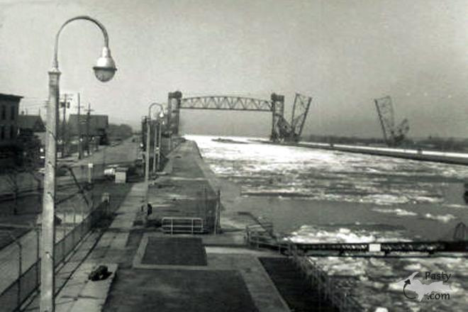
At the same time the military was protecting the Soo Locks and St. Mary's River system, German U Boats were sinking merchant vessels on the east coast of the United States. I wrote a newspaper story about a man who served at the Soo during WWII. He made the comment that if the locks had been destroyed or damaged or a freighter been sunk in the river system, the steel industry would have ground to a halt and the defense industry would not have had the materials to build ships, planes, tanks, etc. The enormity of the need for the ore coming through the Soo Locks can be seen in the fact that 2,751 Liberty Ships alone were built during the war years. They were constructed of 250-ton pre-fabricated sections. Add in the thousands of tanks, planes, aircraft carriers, landing vessels, etc and you can quickly see the importance of protecting what we commonly view as one of Michigan's tourist attractions.


Powered by:  
Join Today!
Messages can no longer be posted to these older discussion pages, but you are welcome to join the conversation on Today's Pasty Cam

Here's a list of messages posted in the past 24 hours

See our guest photo gallery for more great views from the U.P.

While in the Copper Country be sure to visit
On US-41 north of Calumet
on US-41 in Kearsarge, a mile north of Calumet.
(The home of Pasty Central)

Home | Pasty Cam | Contest | Order Now | Bridge Cam | Pasty.NET | GP Hall of Fame | Making Pasties | Questions