Jan 05-01

Past-E-Mail: Cam Notes - 2001: January: Jan 05-01
Mid-Winter Midnight    ...scroll down to share comments
Photo by Jon Hopper

By
Charlie at Pasty Central on Friday, January 5, 2001 - 10:47 pm:

Have you ever traveled the Keweenaw at night? (Whoops... that narrows it down). Hmmm... those limbs hang like cedars among pines. Look closely across the road surface. I bet those are deer tracks to the left and right of the tire ruts.

Let's look for other clues. Any road signs? Way down at the end of the light there appears to be a reflection to the right... and... is that a mailbox or something on the left? Maybe you can see it even better by downloading a wallpaper size version of this fascinating shot. (Of course, do a right mouse click on that picture and "set as wallpaper" to put it to use.)

Any idea where we're standing?


By mm, IA on Friday, January 5, 2001 - 11:06 pm:

Cliff Drive????


By KJ, Palo Alto CA on Saturday, January 6, 2001 - 12:13 am:

From the type of trees and the narrow road (no shoulders to speak of), I'd guess M26 North of Eagle river. The light spot on the right in the distance is probably one of the many curve signs on that road.


By Erik, Wi. on Saturday, January 6, 2001 - 12:14 am:

Not sure where this is but I have seen this view many times driving to grandmas for Christmas. We have had a record snowfall in South Central Wisconsin, but not like the U.P. Please send more!!!!!(snow)


By Bill Penprase on Saturday, January 6, 2001 - 12:15 am:

Looks like you are heading toward Phoenix on US 41 just before the sign that shows the snowfall. Beautiful picture -- what kind of lights do you have on that vehicle?


By Liz Benson, Pocatello ID on Saturday, January 6, 2001 - 12:21 am:

Maybe its the Lakeshore road between Eagle River/Eagle Harbor near the park as you enter Eagle River cause that is where the deer usually hang out.


By Melissa, MI on Saturday, January 6, 2001 - 02:43 am:

It looks like the Highway just after you leave Eagle River, going towards E. Harbor, running next to all the camp roads (right behind our house!)


By Charlie at Pasty Central on Saturday, January 6, 2001 - 07:11 am:

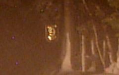
Wow! I thought this would have been a lot harder, but most of these guesses, which were posted overnight, narrowed it right down. While it does look a little like Cliff Drive, the cedars and deer tracks indeed reveal M-26 just north of Eagle River. To be exact, here's the sign reflecting in the distance (road 9):

Zooming in
Thanks to all of our on-line friends all across the country who help make these pages come alive with your comments and memories.
By Tom Cat on Saturday, January 6, 2001 - 09:49 am:

#9 gave it away. The road between Eagle River and Eagle Harbor.M-26. My first guess would have been the Eagle Harbor cut Off Road.


By Alice A., Alaska on Saturday, January 6, 2001 - 01:30 pm:

I'm envious of your snow. Here in Anchorage, Alaska, we got about two inches on Monday. Beneath that, there's about two inches of ice. Send some snow north, please. No dog mushing without it.


By Carole , Sterling Hts. Mi. on Saturday, January 6, 2001 - 02:24 pm:

I didn't even have to scroll down to the #9 sign to know that is M26 between Eagle River and Jacobs Creek. As KJ indicated, the narrow road and no shoulders is a dead give away. Definitely will be a screen wallpaper.

Thanks for providing us with all the beautiful winter shots.


By FRED AND GAY on Saturday, January 6, 2001 - 07:29 pm:

HI CHARLIE, JON AND ALL IN EAGLE RIVER
HOW IT WARMED OUR HEARTS AND SPIRITS TO CLICK ON PASTY CAM AND SEE THIS PIC. FRED AND I GUESSED
THE ROAD BELOW OUR BELOVED "GITCHE GUMEE"
OUR BEST NEW YEAR'S WISHES TO OUR DEAR FRIENDS IN COPPER COUNTRY. FRED AND GAY BELMONT, MI


By jeff, MN on Saturday, January 6, 2001 - 11:26 pm:

I once fished the Garden City Creek near here and caught my limit of speckled trout in a Detroit minute. To counter the constant snow-blindness, I used a tie-dyed fly on a 30 oz test line dipped in day-glo orange while wading through waist-deep snow in my argyll overalls.
I seem to remember crossing paths with an Eagle River snow-shoer who momentarily mistook me for Heikki Lunta's lesser known cousin Jack.
God do I miss the North Shore Winters...


By Bill Penprase on Saturday, January 6, 2001 - 11:41 pm:

Its obvious that I've been away too long when I don't recognize that road. I couldn't read the sign but I should have identified the road by the trees along the side. That road was known as the Military Road when I was a kid and was gated on the Eagle River side.


By Pining Yooper in TrollLand on Sunday, January 7, 2001 - 10:53 am:

Are those two "alien eyes", center, mid-picture, above the trees?(:->)


By k p m j on Sunday, January 7, 2001 - 12:30 pm:

My family looked at this picture and we really think it is M26!


By William Abraham Allegan Mi on Tuesday, January 9, 2001 - 12:55 pm:

are you sure you are not down below in the allegan state game area? haven't been to the U.P. in a long time,maybe this summer,or next winter,michigan is GOD's Country! from the top to the bottm,


By St. Johns, Mich on Friday, October 19, 2001 - 01:24 pm:

pc2002


By Marti, GR, MI on Friday, October 19, 2001 - 03:10 pm:

pc2002


By SueH on Sunday, October 21, 2001 - 08:55 am:

pc2002


By Lori, Iowa on Sunday, October 21, 2001 - 09:02 pm:

pc2002


By DM/LL on Monday, October 22, 2001 - 06:38 pm:

pc2002


By D&JPuro/MI on Monday, October 22, 2001 - 08:32 pm:

pc2002


By Mary Wisconsin on Tuesday, October 23, 2001 - 04:28 pm:

pc2002


By Stefani, IL on Wednesday, October 24, 2001 - 08:20 am:

pc2002


By ts on Wednesday, October 24, 2001 - 08:23 pm:

pc2002


By eric on Thursday, October 25, 2001 - 03:24 am:

pc2002


By Alice, CA on Friday, October 26, 2001 - 03:11 am:

pc2002


By Lori, Rhode Island on Friday, October 26, 2001 - 12:03 pm:

pc2002


By former yooper on Tuesday, October 30, 2001 - 12:19 pm:

2002


By Kathleen Baker, MI on Wednesday, October 31, 2001 - 06:35 pm:

pc2002


By jcg/sjg,wi. on Wednesday, October 31, 2001 - 10:20 pm:

pc2002


By ed from nc on Saturday, November 3, 2001 - 03:10 pm:

pc2002


By kirk, mi on Monday, September 30, 2002 - 11:51 am:

old joes road


Powered by:  
Join Today!
Messages can no longer be posted to these older discussion pages, but you are welcome to join the conversation on Today's Pasty Cam

Here's a list of messages posted in the past 24 hours

See our guest photo gallery for more great views from the U.P.

While in the Copper Country be sure to visit
On US-41 north of Calumet
on US-41 in Kearsarge, a mile north of Calumet.
(The home of Pasty Central)

Home | Pasty Cam | Contest | Order Now | Bridge Cam | Pasty.NET | GP Hall of Fame | Making Pasties | Questions